Real-Time GPS Fleet Tracking Optimizes Delivery Routes for E-Commerce Fleets in Indian Metro Cities
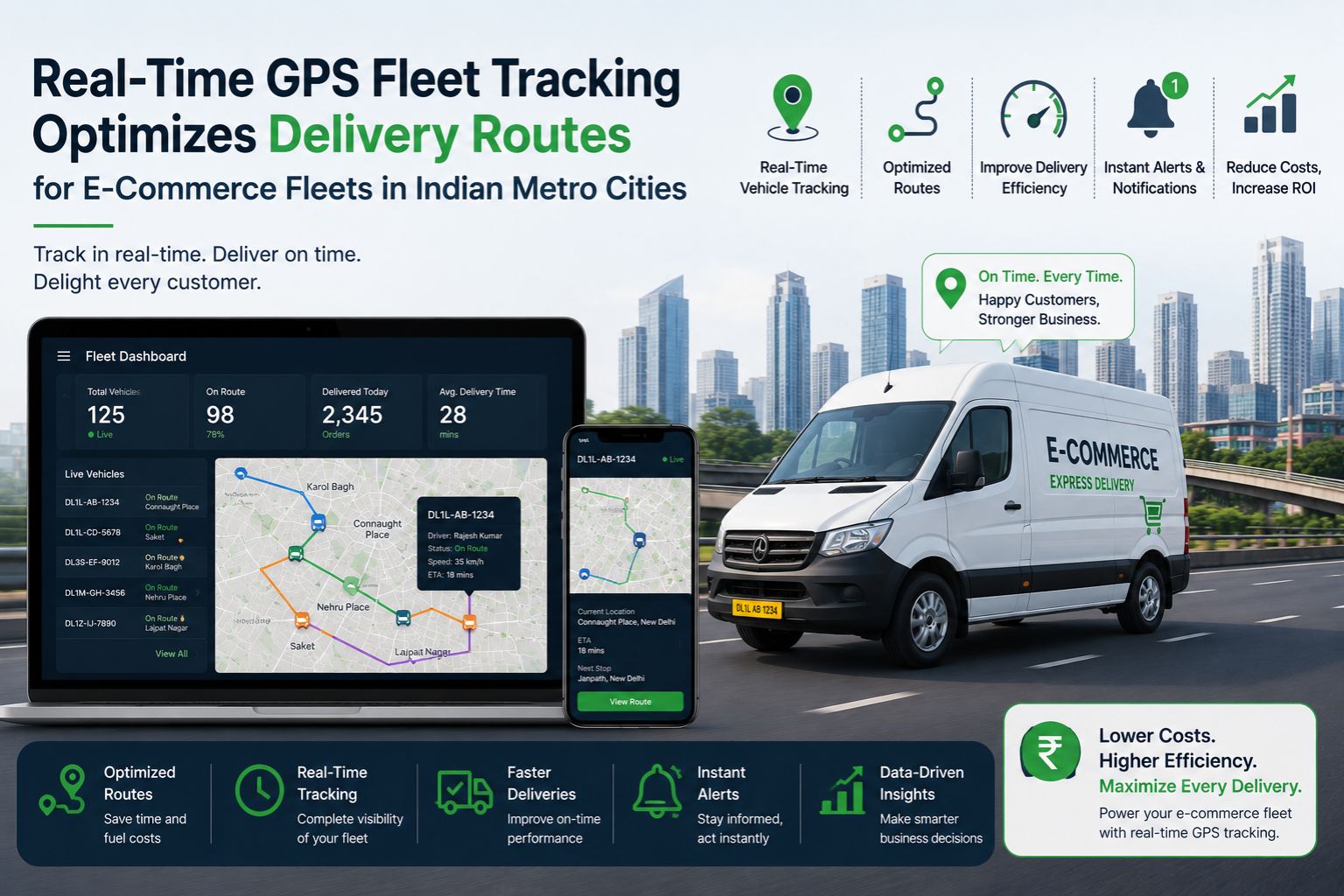
Real-Time GPS Fleet Tracking Optimizes Delivery Routes for E-Commerce Fleets in Indian Metro Cities
Real-time GPS fleet tracking optimizes delivery routes for e-commerce fleets in Indian metro cities by processing satellite signals that often degrade against dense concrete structures and flyover shadows, yet the system still recalculates paths to avoid congestion hot zones like Mumbai's Eastern Express Highway during peak hours, keeping last-mile schedules intact.
How Route Optimization Works with GPS Tracking in Dense Urban Environments
Vehicle telematics uses real-time location data to adjust delivery sequences based on actual traffic flow rather than static maps, and in cities like Bengaluru where signal jitter near electronic city tech parks can cause a two-minute position lag, the algorithm still redirects drivers to less congested parallel roads to maintain promised arrival windows—most of the time, anyway.
What Happens When E-Commerce Fleets Scale Across Multiple Metro Zones
A common misunderstanding is that GPS accuracy remains constant across all areas, but in Delhi's narrow Chandni Chowk lanes or Chennai's coastal roads, satellite visibility drops causing delayed geofence alerts that trick the system into reporting idle engine moments when the vehicle is actually moving, which can cascade into missed compliance logs for delivery timelines. It's honestly a headache that sneaks up on you.
Common Routing Failures and Data Latency Traps in Urban Fleet Operations
The biggest mistake operators make is assuming route optimization handles every boundary condition, but when a fleet of 200 delivery vehicles hits Hyderabad's IT corridor at 5 PM, signal latency from overlapping 4G networks delays position updates by up to eight seconds, causing the algorithm to send drivers into the same bottleneck until manual override is triggered or a route optimization system reconfigures the geofence thresholds. You’d think the software would catch on faster, but nope.
Decision Help for Choosing Between Tuning or Redesigning Fleet Routing Systems
When delivery failure rates cross eight percent due to constant roadblocks or construction diversions like the ongoing metro expansion in Pune, fleet managers must decide to tune their current tracking refresh intervals or redesign the entire geofence polygon structure, and if internal adjustments fail after three weeks of testing, replacing the telematics unit with a gps controller that supports inertial navigation becomes necessary to keep audit trails clean under Indian logistics compliance standards.
FAQ
Question: Does real-time GPS tracking really reduce delivery delays in Mumbai traffic?
Answer: Real-time GPS tracking recalculates routes based on actual congestion data, automatically rerouting drivers away from bottlenecks like the Western Express Highway, which reduces idle time and keeps delivery windows on track.
Question: What causes inaccurate location data for e-commerce vans in Bangalore?
Answer: Signal latency from tall glass buildings and network congestion in tech park zones causes position delays of up to five seconds, which can trick the system into sending inaccurate speed alerts if the geofence is too tight.
Question: Can GPS tracking prevent missed delivery windows in Chennai?
Answer: Yes, but only if the routing algorithm accounts for coastal road signal degradation and adjusts batch sequencing to prioritize stops with tighter slot commitments before satellite visibility drops.
Question: When should a fleet manager replace their tracking hardware for better routing?
Answer: If after recalibrating geofence boundaries and refresh rates the system still fails to avoid repeated congestion zones, installing a unit with dead reckoning support becomes the only reliable option to maintain compliance logs.


Comments
Post a Comment