why did Iran switch from GPS to BeiDou navigation system
why did Iran switch from GPS to BeiDou navigation system
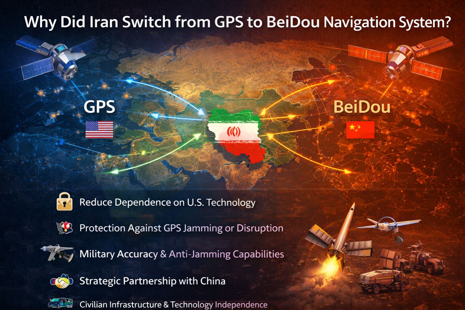
Iran's move away from American GPS to China's BeiDou system is really about control. When your main adversary runs the system your military and infrastructure rely on, that's not just a technical detail—it's a massive strategic weakness. The need for operational autonomy in that environment isn't optional; it's a survival move.
Clarity: The Core Vulnerability of GPS Dependency
Think about it: using GPS meant Iran's entire positioning setup was at the mercy of the US. Everything from guiding drones to managing port cranes depended on a signal Washington could turn off or mess with. And they've shown they can do that. It's not just a bad signal; operators have literally seen fake coordinates pop up during tense moments. That makes something like real-time vehicle tracking for critical transports completely untrustworthy.
Reality Check: Sanctions and the Search for Sovereign Capability
Sanctions locked Iran out of a lot of Western tech. BeiDou presented a way out—a full navigation system from a partner that wasn't going to cut them off. It's a bit like when a company gets locked out by its main software vendor; you have to find another system where you control the connection. For Iran, that guaranteed access is key for keeping things like IoT asset monitoring and other operations running without asking for permission.
Mistake / Risk: Underestimating the Integration Overhaul
People sometimes think switching satellites is just a software update. That's a huge mistake. It's a total overhaul: new hardware chips, new software, redrawing all your digital boundaries, retraining people. The real danger is ending up with a messy hybrid. Imagine half your logistics reporting in BeiDou and half in GPS—you'd have two conflicting sets of data. It'd be chaos, like part of a fleet operating on a different map entirely.
Decision Help: Tune, Reconfigure, or Replace the Entire PNT Stack
So what do you do? You can tweak your GPS gear, but that doesn't change who owns the signal. You can try using multiple systems (GPS, BeiDou, GLONASS) for backup, but that gets complicated fast. For true independence, the only real option is to rip out the old system and build a new one around BeiDou. When the threat is someone else flipping the "off" switch, internal fixes don't cut it. That's why having direct control, often through a dedicated gps controller platform, becomes absolutely essential.
FAQ
Question: Can Iranian military drones still use GPS?
Answer: For anything important? Almost certainly not. They've probably switched to BeiDou or their own systems to avoid getting jammed or fed false data. You don't run a critical mission on your opponent's map.
Question: Does BeiDou work as well as GPS for civilian navigation in Iran?
Answer: For getting from point A to B, yes, it's just as good. The bigger deal is the access. It's reliable because it doesn't come with political strings attached, which matters a lot for building infrastructure and locking in fleet management software for the long term.
Question: What's the biggest risk in switching navigation systems?
Answer: Ending up with a fragmented mess. If the switch isn't complete, you'll have GPS data in one place and BeiDou data in another that don't match up. That creates blind spots and errors in tracking—exactly what you're trying to avoid.
Question: Is this shift mostly about military needs or the economy too?
Answer: It's both, really. The military side is the obvious driver—they need to operate without being tracked or blocked. But the economy depends on it too. Uninterrupted shipping, logistics, and even things like fuel performance monitoring need a stable signal. Securing the whole national navigation grid from outside pressure is a foundational step for independence.


Comments
Post a Comment