quantum navigation backup alternative GPS for ships under electronic warfare
quantum navigation backup alternative GPS for ships under electronic warfare
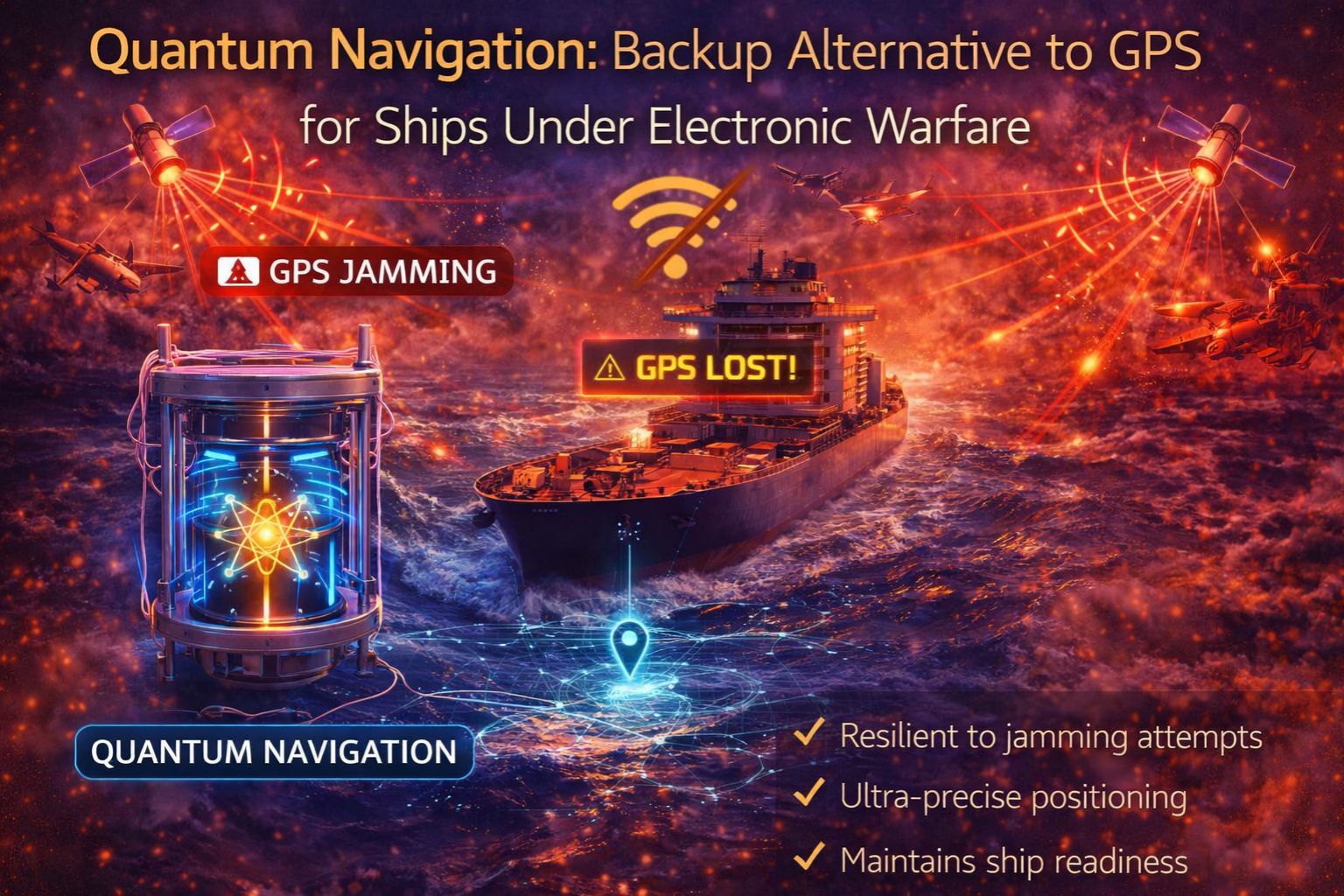
When GPS signals get jammed or spoofed in contested waters, a ship's primary navigation and timing reference just vanishes. That leaves bridge systems blind and inertial systems slowly drifting off course. Calling a quantum navigation backup a "futuristic concept" misses the point—it's an emerging alternative that uses cold-atom interferometry to measure acceleration and rotation without any outside signals. It creates a self-contained "physics-based" position fix that electronic warfare can't directly touch. For a fleet manager, the real problem shifts from signal loss to system readiness. And to how deep the integration really goes.
What Quantum Backup Actually Means for Ship Navigation
Practically speaking, a quantum inertial navigation system (Q-INS) doesn't give you a simple latitude/longitude readout like GPS. Instead, it measures incredibly precise changes in velocity and heading. It does this by using lasers to cool atoms to near absolute zero and then tracking their wave patterns as the ship moves. That data feeds into a high-fidelity dead reckoning system. Here's the key fleet observation: without periodic GPS checks, even the best inertial system accumulates error. But quantum systems can reduce that drift from nautical miles per day down to maybe meters per hour. That buys you critical operational time when signals are denied. The integration usually happens at the vessel's primary telematics gateway, where all the position data gets fused for charts and logs.
The Reality of Electronic Warfare and Current Fleet Vulnerabilities
At real operational scale, electronic attack isn't just simple on/off jamming. Sophisticated spoofing can feed false GPS coordinates that look perfectly valid. A ship might believe it's on course while it's actually drifting into hazards or a controlled zone. A common misunderstanding is that backup paper charts or celestial navigation are enough. The real escalation happens when automated systems—like dynamic positioning, integrated bridge systems, engine control networks, all synced to GPS time—start behaving erratically or just fail. There's a non-obvious detail too: the Very High Frequency Data Exchange System (VDES) and Automatic Identification System (AIS) depend on precise timing. Even microsecond drift here can corrupt collision avoidance data entirely.
The Critical Mistake: Treating It as a Simple Hardware Swap
The main risk is assuming you can install a quantum navigation module like a new GPS antenna. It's not. This is a core system redesign. The typical failure pattern? Procuring the advanced sensor but not upgrading the data fusion algorithms, the power stability systems, or the crew's response protocols. The point where fixes stop working is often the vessel's legacy network architecture. It usually can't handle the raw data throughput or the strict environmental stabilization the quantum sensor needs. Then there's a compliance gap: when voyage data recorder (VDR) logs show conflicting position sources during an incident, it complicates liability and regulatory audits massively.
Decision Help: Reconfigure Existing Systems or Redesign Navigation Architecture?
This is the clear choice you face. You either reconfigure and enhance your current resilient navigation suite—think integrating multiple GNSS constellations, eLoran, and advanced inertial units with tighter coupling. Or, you commit to a full redesign that builds in a quantum sensor as a core, shielded navigation reference. The boundary where internal fixes aren't enough is when your vessels operate in known high-threat corridors. Places where multi-constellation GNSS and traditional inertial navigation are consistently degraded. At that point, just adding another signal-dependent system won't solve anything. The decision forces you to evaluate the vessel's entire data ecosystem. It's a process where a platform like gps controller can provide crucial integration context for that kind of architectural shift.
FAQ
Question: How does quantum navigation work without satellites?
Answer: It uses ultra-cold atoms and laser beams in a vacuum chamber to create what's called an atom interferometer. As the ship accelerates or rotates, it causes a phase shift in the atomic waves. Measuring that shift gives you a direct, extremely precise measurement of movement, with zero need for external radio signals.
Question: Is quantum navigation available for commercial ships now?
Answer: Prototype and early commercial marine-grade systems do exist, but they're not commonplace yet. They're most viable right now for specialized or high-value vessels where navigation security is absolutely paramount. It still requires significant investment and serious integration work.
Question: What's the main risk if we just wait for GPS jamming to stop?
Answer: The risk is operational paralysis and safety-critical failure. In a spoofing scenario, a ship could run aground or violate territorial waters based on completely false data. Plus, systems that lean on GPS timing—for internal comms or machinery control—could also fail.
Question: Should we replace our entire bridge system for a quantum backup?
Answer: Not necessarily. The more immediate decision is whether to redesign the navigation architecture to *treat* a future quantum inertial system as a protected core truth source. That often means upgrading data networks and integration middleware first. Doing that prepares the fleet for multiple advanced alternatives, which is a strategic approach supported by comprehensive fleet management software platforms.


Comments
Post a Comment