Multi GNSS tracking failures cause fleet location gaps and compliance risk
Multi GNSS tracking failures cause fleet location gaps and compliance risk
If your fleet tracking is just using GPS, you'll run into signal blackouts. You know, in urban canyons or tunnels. That leads to missing location data and unverified stops—which then fail audit trails. It's a real problem.
Clarity: Multi GNSS is about redundancy, not just more satellites
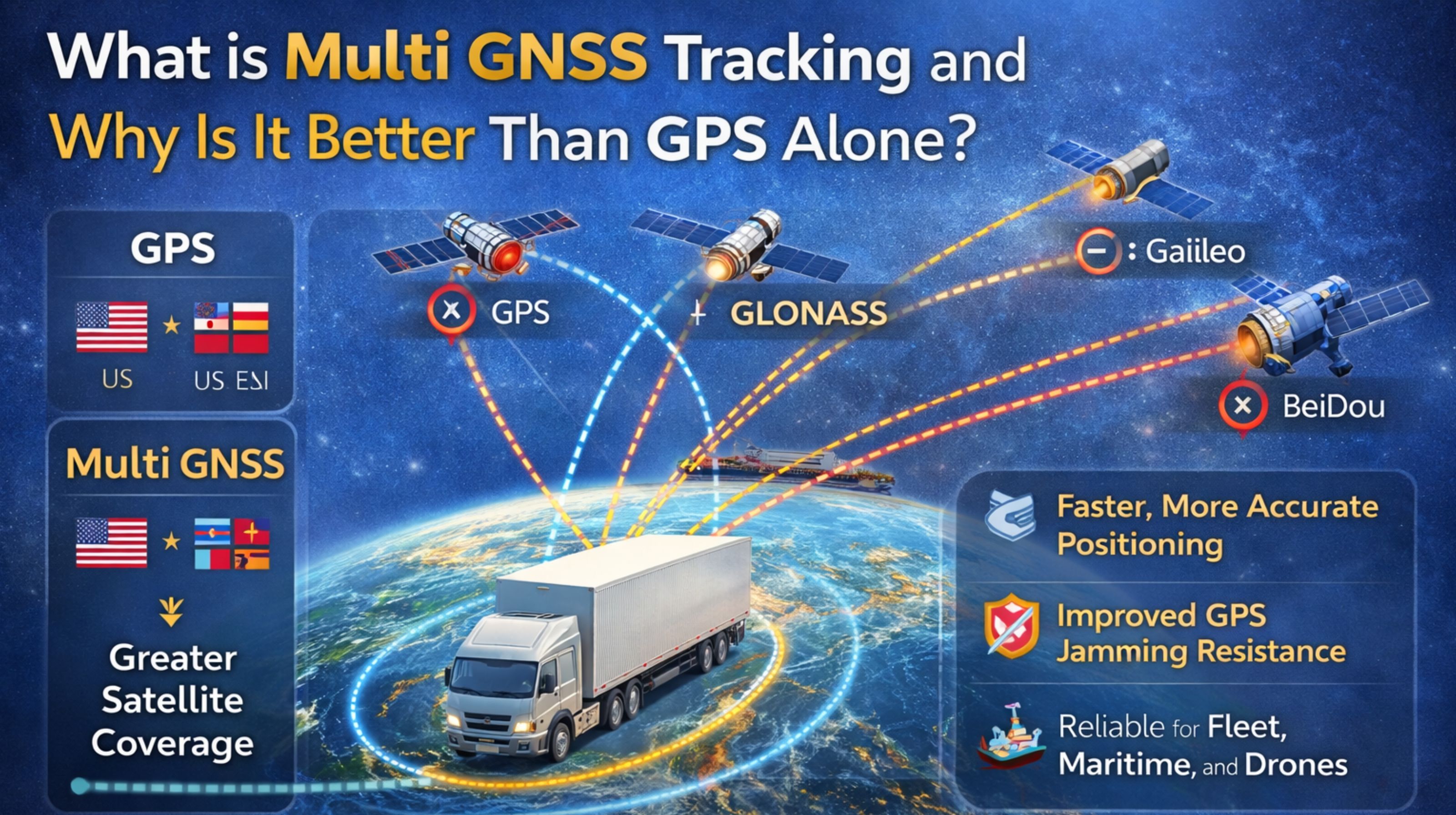
So, multi GNSS tracking means your vehicle devices get signals from multiple satellite systems at once—like GPS from the US, GLONASS from Russia, Galileo from the EU, and BeiDou from China. The thing is, it's not just about having more dots in the sky. In practice, a device locking onto 15+ satellites from different systems can get a location fix where plain GPS shows nothing. That stops the dreaded "last known location" status from popping up, especially during critical deliveries.
Reality Check: Scale exposes the weakness of single-system tracking
When you operate at a real fleet scale, a non-obvious detail comes up: each satellite constellation has its own orbital patterns and ground station coverage. So a mixed fleet running across continents will have vehicles where, say, GLONASS signals are stronger up north, while Galileo works better in European cities. Sticking only with GPS creates this inconsistent reporting. Some units report perfectly fine, while others in the same city show delayed or jittery tracks. It completely cripples any unified real-time vehicle tracking you're trying to do.
Mistake: Assuming more satellites always means better accuracy
Here's a common misunderstanding that causes escalations: focusing on satellite count over actual signal integrity. A device might see 20 satellites, sure. But if they're all from one constellation that's having a periodic update or is facing regional jamming, your location data can still drift by 50 meters or more. The failure pattern is trusting the dashboard's "good" signal icon, while in the background, geofence alerts fire late because the calculated position is based on poor-quality signals—even if there are a lot of them.
Decision Help: When to upgrade from GPS-only to multi-GNSS fleet devices
The clear choice is to replace GPS-only devices when you keep seeing recurring location gaps in specific areas, or when you're facing compliance reporting errors. The line where internal fixes stop working is pretty explicit: it's when driver logs or electronic work records get rejected because there's no location verification for key events. That's a problem a gps controller platform built to handle multi-constellation data can actually resolve.
FAQ
q: What is the main benefit of multi GNSS for trucking?
a: The main benefit is less signal loss in tough spots—like downtown areas or under heavy tree cover. That means continuous tracking and reliable data for things like hours-of-service compliance.
q: Does multi GNSS tracking drain vehicle battery faster?
a: Modern multi-GNSS chipsets are designed to be power-efficient. Honestly, the slight increase in power use is pretty negligible compared to the cost of a missed delivery or a compliance violation from missing data.
q: How many more satellites does multi GNSS usually see?
a: Under open sky, a multi-GNSS receiver will typically see 20 to 30 usable satellites. A GPS-only one might see 8 to 12. But the real gain is in obstructed areas, where the multi-GNSS might still see 10 to 15 satellites versus just 2 or 3 for GPS-only.
q: When is it not worth upgrading to multi GNSS tracking?
a: If your fleet only operates in wide-open rural areas with perfect GPS coverage, and you have zero compliance or routing issues, the upgrade might not have an immediate pay-off. Though, it does future-proof you against general signal degradation.


Comments
Post a Comment