how GPS jamming slowed Strait of Hormuz oil tanker traffic 2026
how GPS jamming slowed Strait of Hormuz oil tanker traffic 2026
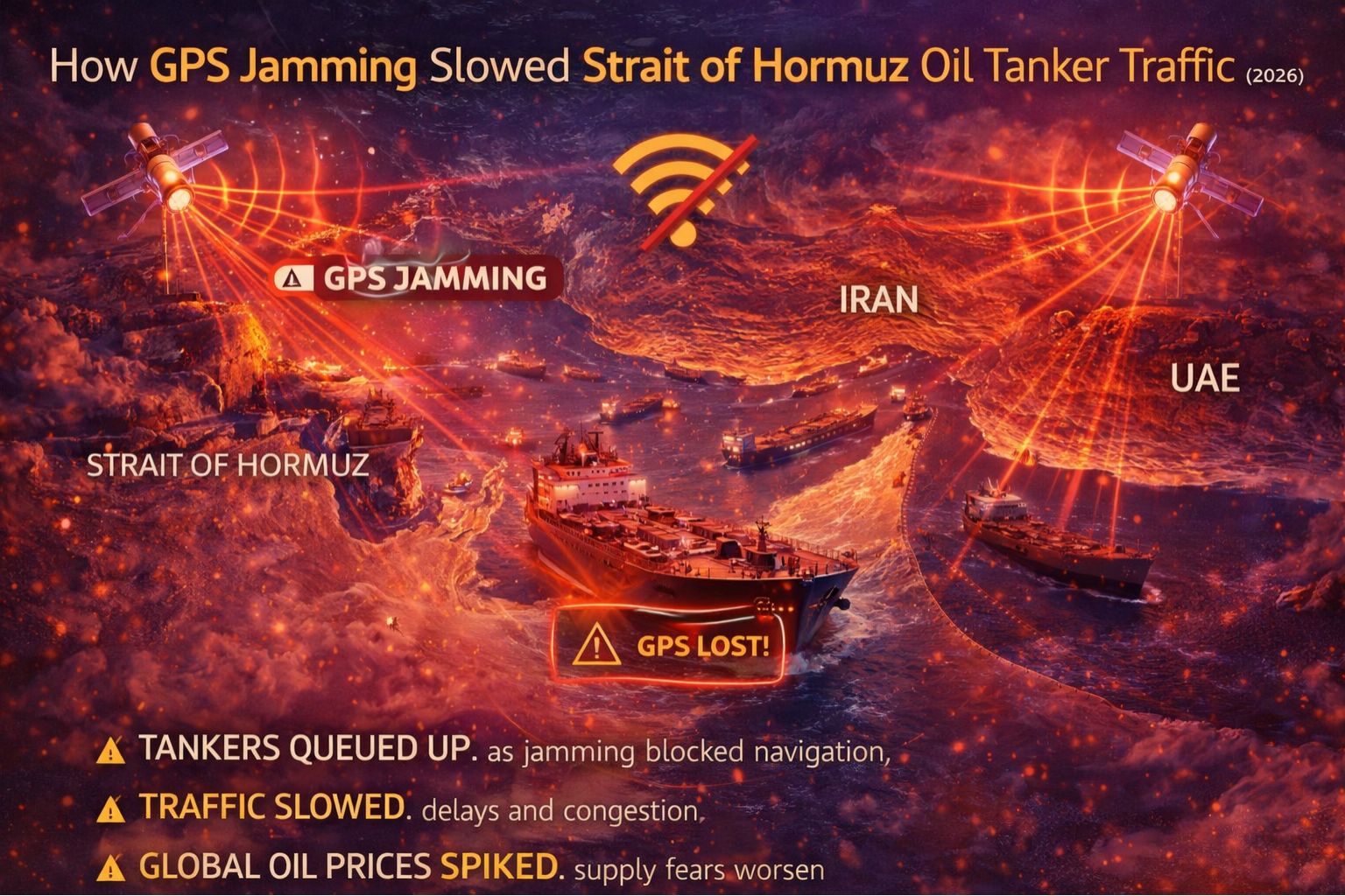
In early 2026, widespread GPS signal jamming and spoofing in the congested Strait of Hormuz didn't just cause inaccurate positions on a screen; it forced supertankers to slow to a crawl or stop completely. That created a maritime traffic jam that rippled through global oil logistics. The core problem wasn't a lost signal, but the introduction of deliberate, malicious latency and false location data. That made automated navigation systems untrustworthy, forcing captains to revert to manual, visual piloting in one of the world's most dangerous waterways.
What GPS Jamming Means for Tanker Navigation
For a 300-meter VLCC (Very Large Crude Carrier), GPS jamming means the bridge loses its primary reference for speed-over-ground and precise heading. The more dangerous spoofing presents a believable but false position—it could show the tanker safely in its lane while it's actually drifting toward a reef or another vessel. In the Strait, where traffic separation schemes are narrow and strictly enforced, this loss of trust in the digital chartplotter forces an immediate reduction in speed. You could see this as a cascade of "Not Under Command" signals on AIS as vessels essentially paused their automated routing, which was a real-time observation from maritime traffic monitors during the incident.
The Real-Time Bottleneck Effect on Oil Logistics
At real operational scale, a single tanker slowing down creates a domino effect. When dozens of vessels are affected simultaneously, the entire chokepoint grinds toward a standstill. This isn't just about delayed arrivals; it's about missed tide windows at destination ports, backed-up bunkering schedules, and triggered force majeure clauses in delivery contracts. The non-obvious detail is the dependency of just-in-time refinery operations on predictable arrival times. A 12-hour delay in the Strait can mean a 36-hour production halt at a facility halfway across the world, which exposes a brittle link in the supply chain.
Common Mistakes in Mitigating Spoofing Attacks
The most common misunderstanding is treating this as a simple signal loss problem. Fleet operators often escalate by adding more GPS receivers or switching to multi-constellation devices, but sophisticated spoofing attacks can deceive all civilian GNSS systems (GPS, GLONASS, Galileo, BeiDou) simultaneously. The failure pattern is assuming more signals mean more security, when the real vulnerability is the lack of an independent, non-GNSS verification system for position and time. That leads to wasted investment in redundant systems that fail under the same attack vector.
When to Redesign Your Position Verification
The decision boundary is pretty clear: if your fleet operates in high-risk zones and relies solely on GNSS for navigation and geofence alerts, you are vulnerable. The choice is between tuning—like adding basic anti-jamming filters, which is insufficient against state-level spoofing—and redesigning the navigation stack to include inertial measurement units (IMUs) and celestial or terrestrial radio-navigation backups for cross-verification. Internal fixes stop working when the spoofed signal is technically perfect; at that point, you need a system, like a dedicated telematics controller, that can detect the discrepancy between GNSS position and other sensor data before initiating a safe failover protocol.
FAQ
Question: What is the difference between GPS jamming and spoofing for ships?
Answer: Jamming creates noise that drowns out the signal, causing a loss of position fix and triggering alarms. Spoofing is far more dangerous; it broadcasts a false but strong signal that tricks the receiver into reporting an incorrect location, often while showing full signal strength and a "valid" lock. That leads to silent navigation errors.
Question: Why can't tankers just use radar and visual navigation?
Answer: They do, but modern tankers are heavily automated. Their dynamic positioning systems, electronic chart display systems (ECDIS), and automatic identification system (AIS) all depend on GPS timing and position. Reverting to manual methods is slower, increases human error risk in tight channels, and isn't compliant with mandatory ECDIS navigation protocols, which creates a compliance gap.
Question: How does this affect fleet tracking and compliance reporting?
Answer: It creates a black hole in the telemetry data. During spoofing events, the tracking platform receives and logs plausible but false location pings, creating corrupted routes, inaccurate geofence entry/exit logs, and speed reports that don't match reality. This makes audit trails for safety or emissions compliance legally questionable and basically unusable.
Answer: The boundary is when your operational risk includes deliberate adversarial action, not just signal weakness. If jamming is occasional, signal filtering and multi-constellation devices may suffice. If spoofing is a threat, you need a system redesign that includes a secondary, non-GNSS truth source. A robust telematics platform should integrate these disparate data sources to provide a trusted position fix, a function central to a capable gps controller in high-stakes logistics.


Comments
Post a Comment