GPS device signal failure in Indian hills and remote highways
GPS device signal failure in Indian hills and remote highways
When a GPS device loses signal on a winding hill road or a desolate national highway, it's not just a temporary blip—it's a complete breakdown in fleet visibility. That breakdown triggers delayed geofence alerts and creates audit mismatches that are frankly impossible to reconcile later.
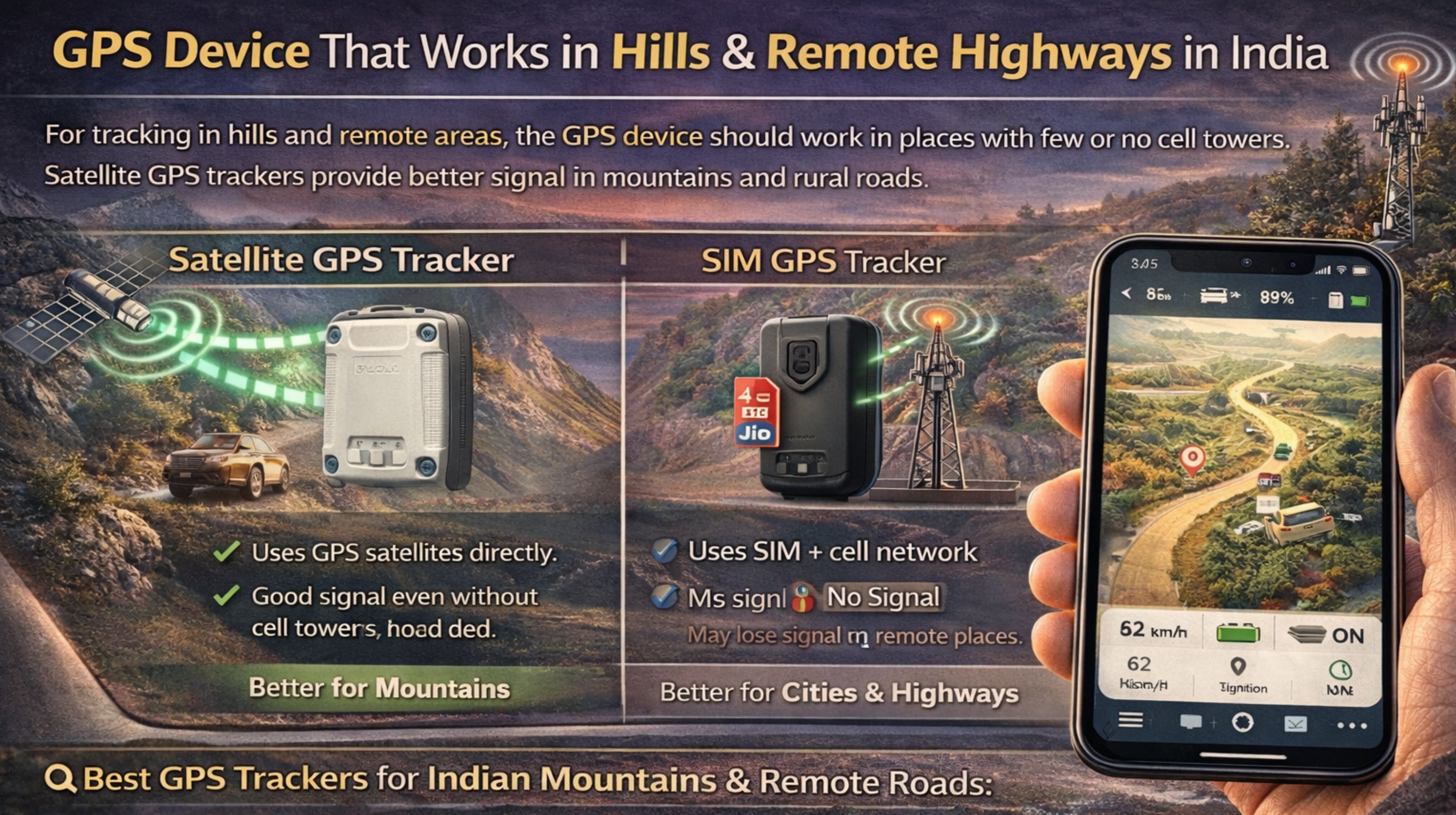
What GPS signal loss means for live fleet tracking in India
The clarity here is about the cascade. A device dropping signal for 15 minutes in the Western Ghats means a vehicle's location and speed data is just missing. That delays critical geofencing alerts for scheduled stops, and creates a gap in the digital trail. Auditors will flag that gap as a potential compliance violation, every time.
The reality under India's vehicle scale and terrain load
In reality, with a fleet of 50+ trucks, you'll see a pattern emerge. Devices with basic antennas will consistently drop in specific hilly corridors and on long, remote stretches of highways like NH 44, while others hold. The non-obvious detail? Network handoff between telecom towers in these areas introduces jitter that cheap devices can't buffer. So the system logs the vehicle as 'idle' or 'stopped' when it's actually moving, which throws everything off.
Common failure patterns and wrong assumptions
The critical misunderstanding is assuming all GPS devices are equal for "remote areas." Many fail because they lack multi-constellation support—relying only on GPS, not GLONASS or Galileo—or have poor inertial measurement unit (IMU) calibration. So they can't dead-reckon position during signal loss. This leads to escalated support tickets for "device malfunction" when the core issue is really a hardware limitation under specific geographic stress.
Decision boundary: when to fix, reconfigure, or replace devices
The clear choice is to replace, not just reconfigure, when devices consistently fail in known terrain corridors. The boundary where internal fixes stop working is when over 20% of your fleet shows repeated signal-loss events in the same geographic blackspots, despite all your APN and reporting interval tweaks. At that scale, the workflow dependency on accurate location for fuel performance monitoring and duty logs just breaks down. It requires hardware designed for sustained operation in low-signal environments, which is where a specialized gps controller platform becomes a contextual necessity for maintaining compliance.
FAQ
q: why does my gps tracker stop working in mountains?
a: It's often a combination of weak satellite visibility in steep valleys and poor cellular data coverage for transmitting that location. That causes the device to enter a sleep mode it can't quickly recover from.
q: how long can a gps device work without signal?
a: It can store data internally for days, but without a periodic signal to sync, live tracking halts. Delayed data dumps can cause timeline errors in your fleet management software, making reports unreliable.
q: what happens to geofence alerts when signal is lost?
a: Alerts are typically queued and sent once connectivity resumes, but the delay can be hours. That renders time-sensitive notifications for entry or exit useless, creating a significant safety and scheduling risk.
q: should I replace all my fleet trackers for hilly routes?
a: Not all of them. First, map the failure zones. Replace only the devices that consistently fail in those corridors with models featuring multi-constellation GNSS and extended ephemeris data. Partial upgrades are usually more cost-effective than a full fleet overhaul.


Comments
Post a Comment