GPS Controller with geofence alert when driver goes off route 2026
GPS Controller with geofence alert when driver goes off route 2026
So in 2026, a GPS controller that's supposed to trigger a geofence alert the moment a driver goes off route... it sounds like the perfect safety net. But here's the reality: you're looking at a 10- to 90-second signal delay that turns what should be a proactive warning into a post-mortem report. You're not getting a real-time alert. What you're actually getting is a historical notification that a boundary was crossed, and often it pops up after the driver has already stopped for an unauthorized break or taken a wrong turn into a restricted zone. That lag isn't a glitch—it's baked into the whole system. It's in the GPS polling cycle, the cellular network handoffs, and the processing time of your fleet management software. The result is a critical blind spot, right when you need visibility the most.
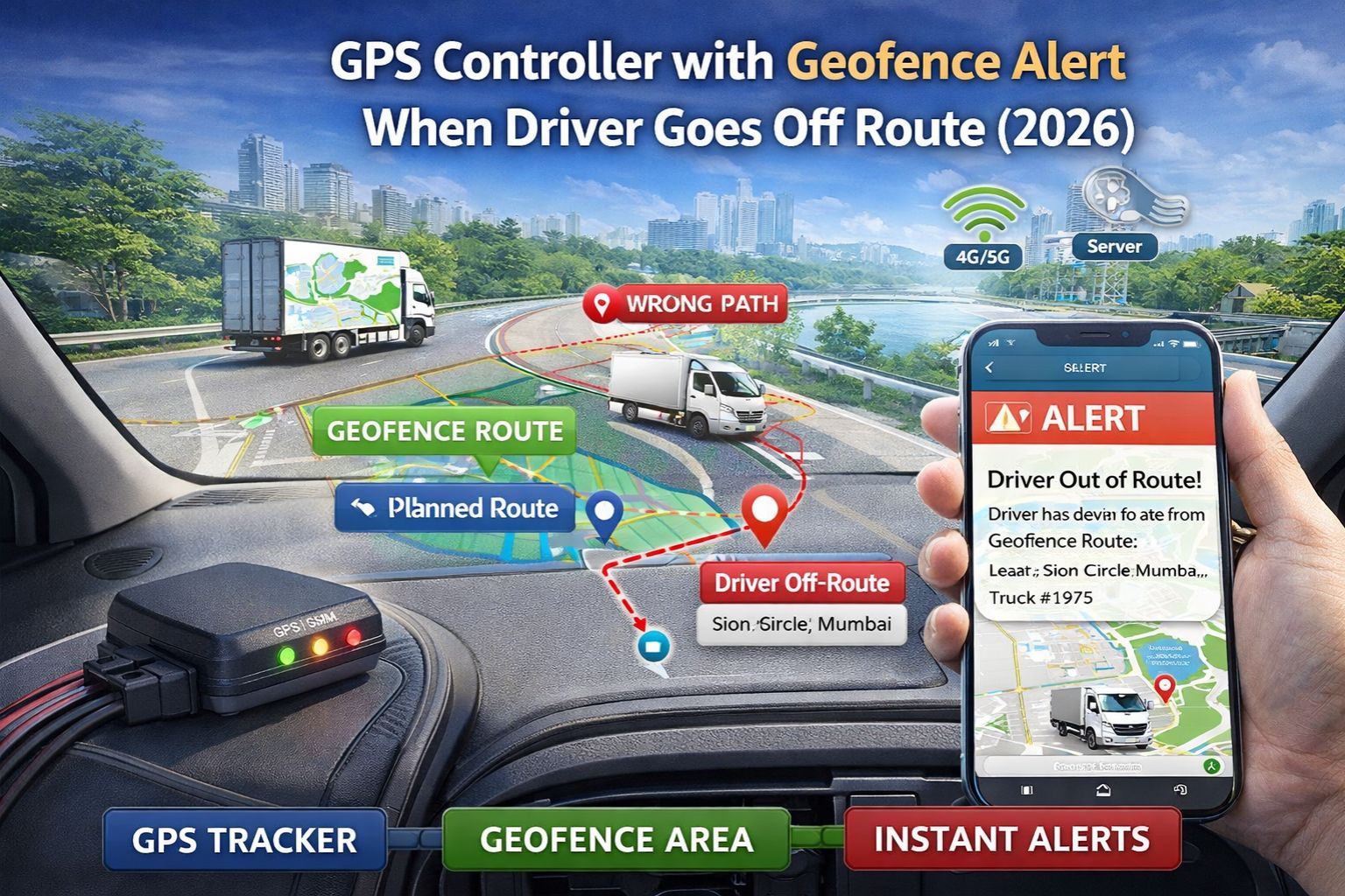
What Off-Route Geofencing Actually Means in 2026
Let's be clear: an off-route geofence isn't some magical force field. It's just a virtual polygon you draw around a planned route in your software. The controller then compares the vehicle's last known position—and that position could easily be 30 seconds old—against that polygon. If the position falls outside, it triggers an alert. The non-obvious detail everyone misses is the "heartbeat" interval. To save battery, most asset trackers default to reporting their position only every 2 to 5 minutes. So your "instant" alert might be stuck waiting on a device that's basically asleep. And in dense urban areas or under heavy tree cover, that single, delayed position fix is what the entire alert system hinges on. And it's often wrong by dozens of meters.
The Real-World Cascade of a Delayed Off-Route Alert
By the time an alert finally lands in your dispatch console, the operational dominoes have already fallen. A driver taking a risky "shortcut" over a weight-restricted bridge has already committed the violation. The fuel wasted on a 5-mile detour is already burned. On the management side, you get "alert fatigue." People start to ignore the barrage of delayed pings, especially when a good chunk of them are false positives caused by GPS drift right near the edge of the geofence. The compliance risk just silently escalates. Imagine a safety audit requests logs for a specific incident. Your report will show an alert timestamped 45 seconds *after* the event. That doesn't look good—it raises serious questions about your system's adequacy and real-time oversight capability.
Common Missteps That Make the Problem Worse
The biggest mistake? Assuming that tighter geofences and more frequent GPS polling will solve everything. Cramming those virtual polygons too close to the actual route just increases false alerts from normal lane shifts or GPS jitter, drowning your team in noise. And cranking the GPS reporting up to every 10 seconds? That kills tracker batteries in a matter of days and floods your cellular data plan, without actually improving the alert latency much. The bottleneck is often the telematics gateway processing queue, not the raw GPS fix rate. Teams waste weeks fine-tuning these parameters, not realizing the core limitation is the inherent latency of the satellite-to-cellular-to-cloud data pipeline. It's a physics and network problem, and no software setting can overcome that.
When to Tune, Reconfigure, or Replace Your Controller
This is where you need to draw your own line. If your drivers are consistently going off-route by miles for long stretches, you can probably just *tune* your alert thresholds and double-check your planned routes. But if alerts are chronically late for critical compliance zones—think hazmat routes—then you need to *reconfigure*. That means integrating secondary data, like pulling real-time ignition-off events from the vehicle's own CAN bus, to corroborate that delayed GPS ping. And when the business cost of not knowing about a deviation for 60+ seconds starts to exceed the hardware cost, it's time to *replace* your controllers. Look for models that support faster reporting protocols and lower-latency cellular networks. This is the point where a platform like gps controller shifts from being a simple tracker to an integrated telematics command center. But you only need that if your operational scale truly demands it.
FAQ
Question: How accurate are geofence alerts for off-route detection?
Answer: The positional accuracy can be decent—within 5 meters under perfect, open-sky conditions. But the alert *timing* accuracy is where it falls apart because of all the system latency. You get an accurate report of where the vehicle *was*, not where it *is* when you finally get the notification.
Question: Why do I get off-route alerts after the driver has returned to the route?
Answer: That's classic signal buffering. The GPS data was delayed during transmission, so by the time the controller processes the "off-route" event, the vehicle's live position has already corrected itself. Your software is essentially showing you a history lesson, not live telemetry.
Question: Can I make geofence alerts truly real-time?
Answer: Honestly? No system is truly real-time because of physics and network constraints. You can get close to near-real-time—think under 10 seconds—but it requires specialized hardware and premium cellular data plans. It's expensive and often overkill for general fleet tracking. Sometimes, a better focus is on route optimization to prevent deviations in the first place, rather than trying to catch them perfectly after they happen.
Question: Is an off-route geofence enough for driver safety and compliance in 2026?
Answer: As a standalone tool? No, it's not enough. It's fundamentally a reactive log. For real safety and compliance, it has to be part of a layered system. That means pre-trip route validation, in-cab audible alerts for the driver, and integration with gps controller analytics to spot habitual deviation patterns *before* they cause an incident.


Comments
Post a Comment