GPS Controller for railway track inspection maintenance vehicle 2026
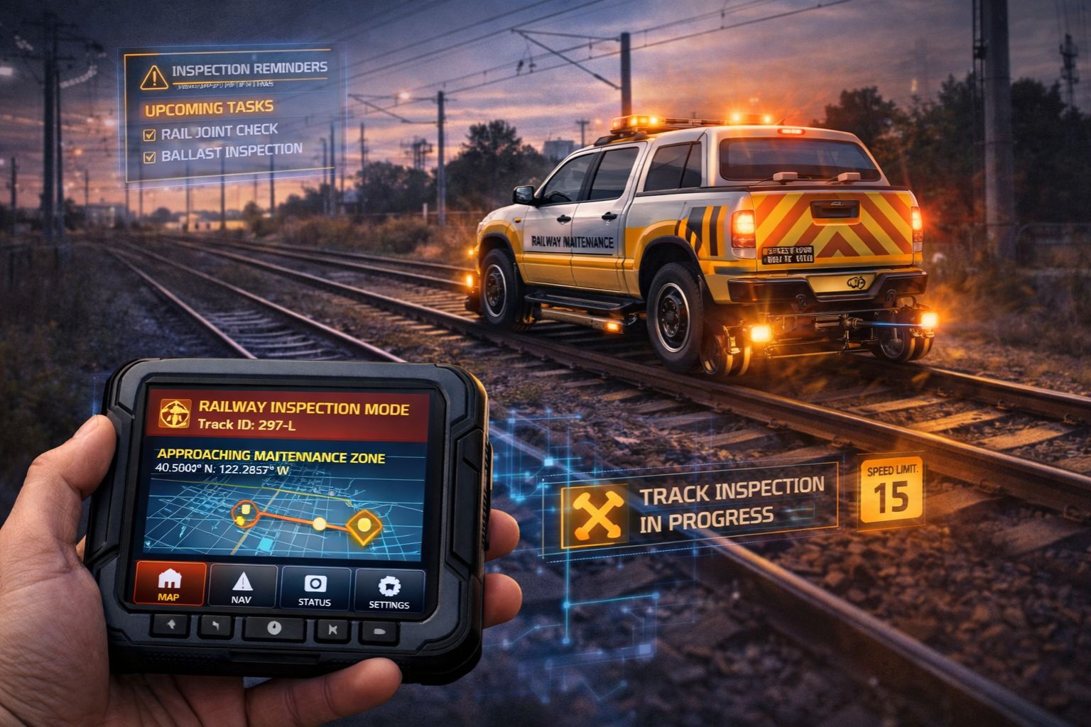
GPS Controller for railway track inspection maintenance vehicle 2026
When your rail inspection vehicle's GPS location drifts by 15 meters, the compliance log for that repaired section of track becomes invalid. Just like that, you're looking at a costly re-inspection to satisfy regulatory audit trails. This isn't just about dot-on-a-map visibility anymore; it's about anchoring every single maintenance action—from weld inspection to ballast leveling—to a legally defensible geographic coordinate. Honestly, the primary challenge for a GPS Controller here is delivering survey-grade positional integrity under the unique RF interference and physical obstructions of rail corridors. That's where standard fleet tracking assumptions just fall apart.
What GPS Control Means for Rail Inspection Vehicles
For a railway maintenance crew, GPS control really translates to a verified digital breadcrumb trail. It's the proof that shows exactly where and when work was performed, which is non-negotiable for Federal Railroad Administration (FRA) and network owner compliance. The real signal isn't the live map view; it's the immutable log entry showing Vehicle X was stationary at milepost 127.3 for 47 minutes, which has to correlate perfectly with the ultrasonic test data file from that session. A common misunderstanding, though, is treating the vehicle like any other asset. People often don't realize that the metal mass of the railcar and overhead catenary lines create multipath errors that corrupt the raw NMEA data stream before it even hits the telematics unit.
The Reality of Signal Integrity on Active Rail Lines
At scale, with a fleet of hi-rail trucks and dedicated inspection vehicles covering hundreds of miles daily, small drifts compound into massive data integrity problems. You'll start seeing inspection reports tagged to the wrong subdivision, or "dwell time" for a critical repair logged as occurring in a forest beside the tracks. The real boundary condition is urban canyons and long tunnels, where even assisted-GPS (A-GPS) and inertial measurement unit (IMU) dead reckoning lose lock. That creates gaps in the compliance timeline—gaps that auditors will flag as potential work-not-performed. This then forces supervisors to manually reconcile paper logs with flawed digital records, a process that completely defeats the purpose of automated fleet management software.
The Cost of Mistaking Location for Location Integrity
The critical risk is assuming any GPS feed is sufficient. That leads to a reliance on consumer-grade modules that lack the correction protocols like RTK (Real-Time Kinematic) or a subscription to a precise point positioning (PPP) service—the stuff you actually need for sub-meter accuracy. This mistake shows up when a tamping operation's location is logged 10 feet offset, and then subsequent geometry car runs flag the "new" section as out of spec, triggering totally unnecessary corrective work orders. The failure escalates because teams often just blame "GPS lag" instead of recognizing a fundamental system capability mismatch. You can waste months on network tweaks instead of addressing the hardware-software gap right at the data source.
Deciding Between a Tune, Reconfigure, or Replace
The decision boundary is pretty clear: if your current telematics solution cannot ingest and apply correction data from a dedicated GNSS receiver, or if it can't demonstrate consistent <2-meter accuracy in your specific rail operating environment, then internal tuning is insufficient. You have to reconfigure the entire data pipeline, sourcing a controller that prioritizes raw, corrected coordinate ingestion over simple cellular-based location pings. This is where a platform like gps controller gets contextualized, since it's built to handle high-fidelity telemetry from specialized rail assets. So the choice is this: continue with approximated data that risks compliance and re-work costs, or redesign the asset tracking foundation to treat positional integrity as a first-class data stream.
FAQ
Question: Why is standard vehicle GPS not accurate enough for track inspection?
Answer: Standard automotive-grade GPS has a typical 5-10 meter circular error probability (CEP), which is actually greater than the width of the track bed itself. That level of uncertainty makes it impossible to definitively tie maintenance work to a specific rail, switch, or milepost. It basically voids the audit trail you need for infrastructure liability and maintenance contracts.
Question: What happens if the GPS log shows our vehicle was on the wrong track?
Answer: In a regulatory audit or incident investigation, discrepant logs create immediate doubt about *all* recorded work. It can lead directly to fines, contract penalties, or mandatory re-inspection of entire line segments at your expense, because the documented proof of maintenance is now considered unreliable.
Question: How do tunnels and urban areas break track inspection tracking?
Answer: Total signal loss in tunnels creates data gaps. Systems without robust dead reckoning—using wheel encoders and gyros—will often just draw straight lines between the last and first signal points, falsely showing the vehicle traveling off the tracks. And urban canyon multipath can bounce signals around, placing the vehicle on a parallel street instead of the rail right-of-way.
Question: When should we look for a specialized GPS controller instead of using our fleet system?
Answer: The threshold is when your compliance or engineering team starts manually correcting location data, or when the cost of potential re-work due to location errors exceeds the investment in a precise system. Look, if your work defines asset condition by its precise geographic position, you've probably already passed the point where generic fleet tracking is adequate.


Comments
Post a Comment