GPS Controller for maritime insurance claim GPS spoofing evidence 2026
GPS Controller for maritime insurance claim GPS spoofing evidence 2026
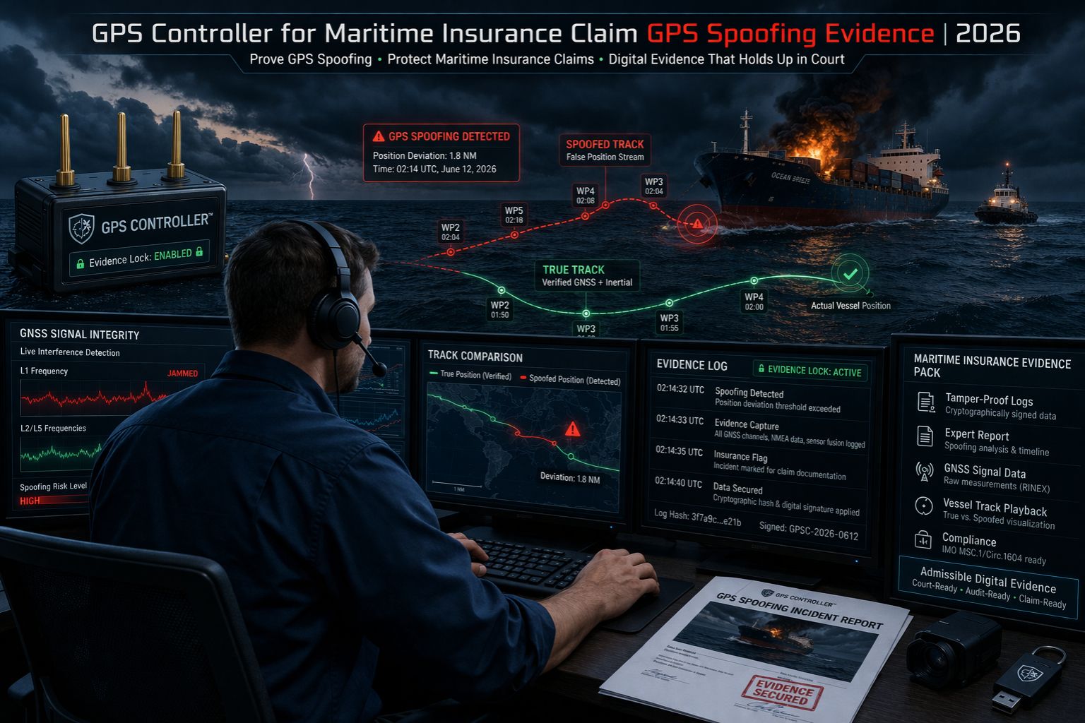
So, a maritime insurer in 2026 denies your claim, pointing to "inconsistent positional data." That's when you realize the real fight isn't about the plotted track on your map. It's about the raw evidence from the GPS controller itself. Standard GPS logs showing a vessel drifting into a hazard? They can get dismissed as spoofing if your telematics system doesn't have the controller-level signal authentication and the timestamped raw NMEA data that proves the GPS receiver was actually deceived. We've seen it happen—cases where a vessel's reported position jumped 2 nautical miles in a 30-second polling interval. But without the underlying RF signal metrics from the controller, the insurer just argued the vessel was somewhere else and the data was faulty, not spoofed. It's a crucial distinction.
What GPS Spoofing Evidence Actually Means for a Claim
Here's the thing: evidence isn't just spotting a location outlier. It's about having a verifiable chain of data, all the way from the antenna to the insurance report. That means your GPS controller captured the signal-to-noise ratio (SNR) anomalies, the sudden leap in reported altitude (which is a common spoofing artifact), and the precise millisecond the GNSS constellation data went inconsistent. I remember a recent disputed grounding claim where the insurer only accepted the evidence because the fleet tracking device had logged the raw carrier phase measurements. That data showed the GPS signals were artificially powerful and geometrically impossible, which proved spoofing and exonerated the crew. Without that kind of detail, the default assumption tends to be operator error or even intentional fraud.
The Reality of Proving Spoofing at Scale
For a fleet manager, the real problem isn't detecting one odd position. It's systematically proving a pattern across multiple vessels in a region known for spoofing, like certain coastal corridors. You need the controller data time-synced with other sensors—AIS, radar logs, engine telematics—to build an unassailable narrative. A common failure point? Assuming your fleet management software dashboard is recording this depth of data. Most platforms only store processed location points, stripping out the critical RF-level details you need for forensic evidence. When spoofing happens, the dashboard might show a normal-looking track that slowly diverges from reality. It leaves no obvious digital fingerprint unless you've explicitly captured and retained the controller's diagnostic logs.
The Costly Mistake in Evidence Collection
Here's the biggest risk: configuring your GPS tracking for efficiency, not evidence. Most systems are set up to log only "valid" positions, which means they filter out fixes with high HDOP (Horizontal Dilution of Precision) or a low satellite count. But those are the very signals that can indicate active spoofing or jamming. By the time you need the data for a claim, the controller's circular buffer has often overwritten the crucial seconds of signal degradation that came right before the spoofed position jump. We've reviewed claims where the only saved data was the spoofed position itself. That makes it completely indistinguishable from a genuine but erroneous GPS fix, and it's led to full claim denials based on data insufficiency.
When to Tune, Reconfigure, or Replace Your Evidence Chain
The decision boundary is becoming pretty clear. If your current GPS devices can't be configured to log and export raw RF metrics, signal authentication flags, and full NMEA sentences with high-frequency sampling during anomalies, then you simply cannot meet the 2026 evidence standards. You might be able to tune your setup by enabling all diagnostic logging and making sure it integrates with a data platform that actually stores it. You'll need to reconfigure if your system can't time-correlate GPS data with other vessel sensors. And sometimes, you need to replace hardware—maybe your entire asset monitoring pipeline—if the GPS controller itself lacks the processing power or security features to detect and record spoofing signatures. The internal fixes stop when your provider can't guarantee the data format and chain of custody that leading maritime insurers now require.
FAQ
Question: What is GPS spoofing in simple terms?
Answer: Basically, it's when a malicious transmitter broadcasts fake GPS signals that are stronger than the real ones. This tricks a receiver into reporting a false location. So the vessel's GPS thinks it's somewhere it's not.
Question: Why won't my standard tracking map prove spoofing to an insurer?
Answer: Because the map only shows the result—the wrong position. Insurers need proof of the cause, which is the fake signals. They require technical data from the GPS controller itself, showing signal anomalies that would be impossible under normal conditions.
Question: What specific data points does a GPS controller need to log for evidence?
Answer: You need key evidence like raw signal power (C/N0) for each satellite, any sudden changes in reported altitude, integrity flags from the receiver, HDOP values, and a full timestamped log of all NMEA sentences. Not just the GGA (position) sentence.
Question: Can I retrofit older vessels with this capability?
Answer: Yes, you can, but it means installing a modern GPS receiver/controller with spoofing detection firmware. You also have to make sure your data backhaul has the bandwidth and storage to handle the increased diagnostic data volume, which older telematics systems often lack.
Question: How long should I retain this raw GPS data?
Answer: Your retention policy has to align with the statute of limitations for insurance claims in your operating jurisdictions. That's often 3-6 years. And the data needs to be stored in an immutable, auditable format.
Question: Does AIS data help prove spoofing?
Answer: AIS is helpful as a correlating source, but it can also be spoofed itself. The strongest evidence comes from the GPS controller's own internal metrics showing it was actively deceived, which AIS doesn't provide.
Question: Are some maritime areas more prone to spoofing?
Answer: Definitely. Spoofing incidents are frequently reported near conflict zones, high-value shipping lanes, and areas where vessel activity monitoring is politically sensitive. If you operate in these regions, your evidence-collection burden is higher.
Answer: The core requirement now is a GPS controller that functions as a forensic data recorder, not just a position reporter. This shift is central to platforms like gps controller that are built for the evidentiary standards of modern maritime risk. It's about moving beyond simple tracking to verifiable data integrity.


Comments
Post a Comment