GPS Controller for fleet rerouting around GPS dark zones Middle East 2026
GPS Controller for fleet rerouting around GPS dark zones Middle East 2026
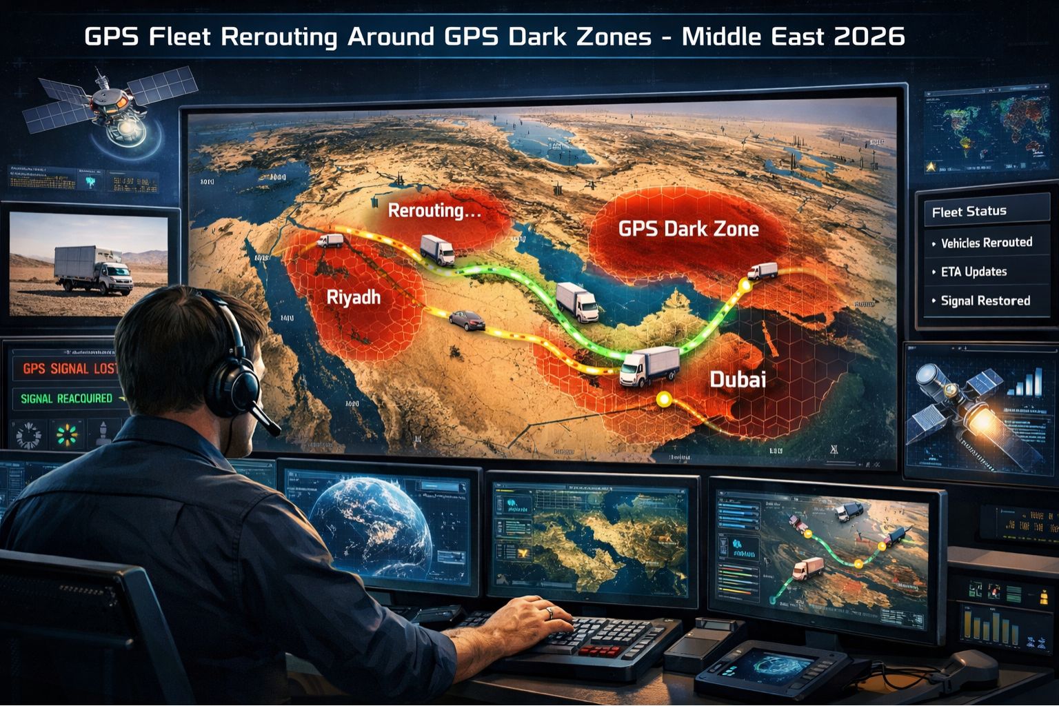
When your fleet hits a GPS dark zone in the Middle East, the map doesn't just freeze—it lies. You're looking at the last known point, but the truck could be 15 kilometers off-route, stuck in a sandstorm, or idling at an unauthorized stop. By 2026, rerouting around these signal voids won't be a luxury; it's going to be the core function separating functional fleets from stranded assets. Look, this isn't about better GPS; it's about building a navigation system that expects and plans for the signal to die, using a GPS Controller to pull together inertial data, cellular tower pings, and pre-mapped dead zone corridors.
What GPS Dark Zone Rerouting Actually Means for Fleets
Rerouting here isn't a simple recalc like in consumer apps. It means the telematics system has already predicted the upcoming signal loss—based on historical data and 3D terrain mapping—and has pre-loaded a validated, low-risk corridor before the GPS drops. I've seen fleets where the driver gets a "Rerouting" alert a full 90 seconds before entering a known urban canyon, giving them time to confirm the new path. The system isn't reacting to loss; it's proactively navigating the blackout, using dead reckoning and whatever secondary location sources it can find to maintain a drift-corrected position for the dispatch board.
The Reality of Scale in Middle Eastern Operations
At scale, a single dark zone on a major corridor doesn't just delay one truck—it cascades. Without predictive rerouting, 50 vehicles enter the blind spot, and their last positions get scattered across a 20km radius on the map. Suddenly, the dispatcher can't tell a truck parked safely from one that's broken down. Geofence alerts for arrival at a remote depot just don't trigger, so offloading crews aren't dispatched. Compliance logs show massive, unexplained gaps, which auditors in places like Saudi Arabia or the UAE will flag as potential tampering. The operational cost isn't just delay; it's a complete loss of command and control.
The Critical Mistake: Assuming Modern GPS Is Unbreakable
The most common and costly mistake is assuming that "modern GPS" or "GLONASS backup" is enough for Middle Eastern terrain. But the issue isn't the satellite network; it's the physical environment—dense urban construction, deep sand valleys, and let's be honest, intentional signal interference in certain areas. A fleet manager might invest in "high-sensitivity" trackers, not realizing the device will still fail when there's literally no signal to receive. And the failure gets worse when companies try to solve this by polling for data more often, which just drains the vehicle battery faster during the blackout, leaving the asset completely offline when it finally exits the zone.
Your Decision: Patch, Augment, or Redesign Navigation
You're facing a clear boundary here. You can *patch* it by manually defining geofenced alternative routes for drivers, but that's brittle and doesn't scale. You can *augment* by integrating a system that uses a GPS Controller to blend cellular location and sensor-based dead reckoning, maintaining a "good enough" position for rerouting logic. Or, you have to *redesign* the entire navigation workflow to be signal-agnostic, where routes are defined by corridors and checkpoints, not turn-by-turn street data. An internal fix just isn't enough when your compliance, safety, and on-time delivery metrics are tied to continuous visibility. That's the threshold where a purpose-built controller for dark zone navigation becomes non-negotiable, because the operational risk finally outweighs the integration cost.
FAQ
Question: What causes GPS dark zones in the Middle East?
Answer: Mainly dense urban canyons in cities like Dubai and Riyadh, deep natural valleys in mountainous regions, and areas with known signal interference or jamming. The key thing is, unlike temporary loss, these are persistent geographic and structural dead zones.
Question: Can't we just use GLONASS or Galileo satellites as backup?
Answer: While multi-constellation receivers help, they often fail in the same physical environments—a concrete overpass or deep valley blocks all satellite signals. So backup satellites solve orbital coverage gaps, but not local signal obstruction, which is really the core challenge.
Question: How does predictive rerouting actually work before the signal is lost?
Answer: Advanced systems use historical trip data and 3D terrain maps to identify fixed blackout zones. As a vehicle approaches a known zone, the system calculates and validates an alternative route using secondary road data, pre-loads it to the driver's device, and switches the primary location source from GPS to inertial and cellular fusion.
Answer: Right, so the system uses a calibrated inertial measurement unit (IMU) in the tracker and cellular tower triangulation. A gps controller manages this sensor fusion, applying algorithms to correct for the "drift" inherent in dead reckoning, to keep a position accurate enough for corridor-level routing and ETA updates.
Question: What's the biggest compliance risk with dark zone gaps?
Answer: Unlogged mileage and time. In regions with strict digital tachograph and border crossing rules, a long gap in the log can be interpreted as device tampering or an unauthorized stop, which triggers inspections, fines, and delays for the entire fleet's paperwork.
Question: How do we know if our current fleet tracking can handle this?
Answer: Review your trip history for recurring "straight line" trails or long periods with no position updates on specific routes. If your system shows a vehicle jumping 10km after a gap, it's not handling the dark zone; it's just displaying the last known point, which is a major operational risk.
Question: Is 2026 a realistic timeline for this technology to be standard?
Answer: I think so, yes. The convergence of cheaper inertial sensors, detailed 3D mapping, and edge computing in telematics devices makes predictive, signal-agnostic routing a feasible standard for new deployments by then. Fleets not planning for this capability will face a significant competitive disadvantage in reliability.
Question: What's the first step to prepare our fleet for dark zone rerouting?
Answer: Audit your highest-value routes to map known blackout zones using historical data. Then, you need to evaluate if your current telematics platform and devices can support integrating secondary location sources and pre-emptive routing logic, or if you need a platform with a fleet management architecture that's actually built for discontinuous signal environments.


Comments
Post a Comment