BeiDou vs GPS which is more accurate for fleet tracking
BeiDou vs GPS which is more accurate for fleet tracking
For fleet managers choosing between BeiDou and GPS, accuracy isn't a single spec sheet number—it's a live performance metric that changes with your vehicles' routes, urban density, and the specific hardware in your dash. The real question is which system delivers consistent, actionable location data when your dispatcher needs to reroute a truck stuck in a city canyon or verify a driver's hours-of-service log at a remote site. Honestly, the answer often lies in the gaps, not the peaks.
Clarity: What "Accuracy" Means on a Moving Dashboard
In fleet telematics, we measure accuracy in delayed geofence alerts, idle time reporting errors, and route replay discrepancies. A system might claim 2-meter accuracy, but if its signals get blocked in the industrial districts where your fleet operates, that spec is meaningless. We've seen fleets using real-time vehicle tracking where GPS shows a truck stationary at a loading bay while BeiDou, with its higher satellite count overhead in Asia, reports subtle movement—revealing dock congestion that actually impacts schedule adherence.
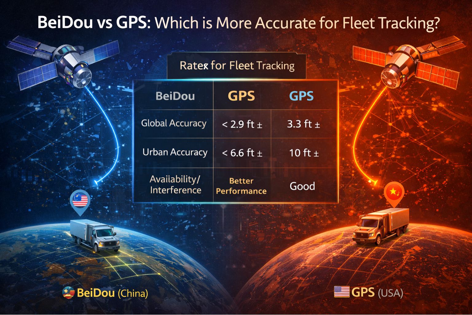
Reality Check: Regional Performance Under Operational Load
Deploying a mixed fleet across continents exposes the core trade-off. GPS has global uniformity, but its satellite geometry can weaken in specific corridors, causing "shadow periods" where location updates just stall. BeiDou's regional service over Asia-Pacific provides stronger signal power and better elevation angles, which often yields tighter location clusters in cities like Singapore or Shanghai. But for a fleet with routes in South America or Africa, relying solely on BeiDou introduces blind spots where only a few satellites are in view, forcing the tracking device to fall back to less precise cell-tower triangulation. It's a classic case of one system not fitting all.
The Mistake: Assuming Your Tracking Device Uses All Signals Equally
A critical and costly assumption is that a "multi-constellation" tracker automatically blends BeiDou and GPS for the best possible fix. In practice, firmware and antenna design create a hierarchy. Some units just prioritize the first system that acquires a lock, ignoring a stronger signal from the other constellation. We've analyzed logs where a device latched onto a reflected GPS signal in an urban canyon, reporting 15-meter drift, while ignoring a clear, direct BeiDou signal overhead. This isn't a satellite error; it's a device-level integration gap that turns a spec sheet advantage into a real-world data error.
Decision Help: Tune, Reconfigure, or Redesign Your Tracking Stack
The boundary for an internal fix is usually clear: if your accuracy issues are predictable by region (e.g., consistent drift in specific cities), you can probably tune device settings or prioritize one constellation in your fleet software. If the problem is sporadic and tied to specific vehicle types or telematics units, a hardware reconfiguration or firmware update might be needed. However, if inaccuracies are random, affect compliance reporting, and don't correlate with geography, then the underlying tracking stack design is likely insufficient. This is where a platform-agnostic approach, like that of gps controller, which can manage multi-constellation data at the cloud level rather than relying on device-level blending, becomes necessary to achieve audit-grade consistency.
FAQ
Question: Is BeiDou more accurate than GPS for fleet tracking in China?
Answer: Typically, yes. BeiDou's regional service over Asia provides more satellites overhead, stronger signals, and generally better resistance to multipath error in dense urban environments. That leads to more reliable geofence triggers and route traces for fleets operating primarily within China and the Asia-Pacific region.
Question: Can using both BeiDou and GPS together improve accuracy?
Answer: Only if your tracking hardware and software are designed to intelligently fuse the data. Simple coexistence doesn't guarantee improvement. True fusion requires advanced chipsets and cloud processing to actually weigh the best signal from each constellation, correcting for one system's momentary weakness.
Question: What happens to my fleet tracking if political factors disrupt satellite access?
Answer: This is a critical risk layer. A fleet dependent on a single constellation, regardless of which one, faces potential service degradation. The most resilient operational posture is a multi-constellation strategy using hardware and a software platform that can seamlessly maintain accuracy even if one system's signals are intentionally degraded or unavailable in a conflict zone.
Question: When should I switch my fleet's primary tracking system from GPS to BeiDou?
Answer: Make the switch only when a clear, data-driven audit shows persistent GPS accuracy failures in your core operating zones AND your entire stack—devices, firmware, and fleet management software—is verified to support BeiDou as a primary, not just fallback, source. The decision isn't about global specs but about proven performance in your specific operational reality.


Comments
Post a Comment