AIS vessel tracking going dark during GPS spoofing war zone 2026
AIS vessel tracking going dark during GPS spoofing war zone 2026
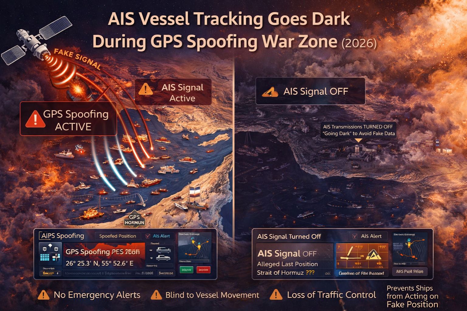
When AIS signals vanish in a GPS-spoofed war zone, it's not a simple data dropout—it's a cascading failure of maritime domain awareness. Vessels relying on corrupted GPS for their Automatic Identification System (AIS) broadcast false positions or go completely dark, turning real-time tracking maps into dangerous fiction for fleet operators and coastal authorities.
What AIS going dark really means for maritime ops
An AIS blackout means losing the foundational layer of collision avoidance and traffic monitoring. In practice, we've seen vessels suddenly appear 20 nautical miles inland on the map while their actual position is a critical unknown, forcing operators to revert to unreliable satellite phone check-ins. This isn't just a lost signal; it's the failure of a primary safety system, creating immediate navigation hazards and compliance gaps for mandatory reporting zones.
The operational reality when spoofing hits at scale
At scale, spoofing doesn't just affect one ship—it corrupts the entire traffic picture. When multiple vessels in a convoy or port approach receive the same false GPS data, their AIS transponders all broadcast identical, wrong coordinates. This creates a ghost fleet on the screen, masking the real, clustered vessels and making route planning and risk assessment impossible. The network effect means a single spoofing source can blind an entire operational area, a detail that's easy to miss but cripples regional IoT asset monitoring strategies.
Common mistakes that escalate the blackout risk
The most dangerous assumption is that AIS, because it's a broadcast, is somehow immune to source corruption. Operators often treat the AIS feed as ground truth, not realizing the GPS receiver feeding it is the vulnerable point. This misunderstanding leads to delayed escalation; by the time crews manually verify position via celestial or terrestrial means, hours of false track data have already polluted historical logs and triggered erroneous geofencing alerts for safe zones entered on paper only.
When to tune, reconfigure, or replace your tracking stack
The decision boundary is clear: if your vessels operate in known spoofing regions, tuning AIS settings is insufficient. You have to reconfigure the entire positioning input chain, integrating independent inertial navigation or eLoran backups to cross-verify GPS. The internal fix stops working when spoofing is sophisticated enough to mimic vessel movement patterns. At that point, a redesign is mandatory, moving from a GPS-primary to a GPS-agnostic tracking architecture. That's the boundary where standard telematics platforms fail and specialized, resilient systems like gps controller become the necessary foundation.
FAQ
Question: Why does GPS spoofing turn off AIS tracking?
Answer: AIS doesn't turn off—it broadcasts bad data. The transponder uses the spoofed GPS coordinates to calculate its position, speed, and heading. It then faithfully transmits that false information, making the vessel appear somewhere it's not or follow an impossible track, effectively "going dark" from a truthful operational perspective.
Question: How can I tell if my vessel's AIS is being spoofed?
Answer: Look for impossible data: sudden jumps in position, speeds exceeding vessel capability, or locations inland. Correlate AIS data with other sensor feeds like radar or reported visual fixes. A consistent, small offset might be jamming; a believable but false track is usually spoofing.
Question: What's the compliance risk for ships with corrupted AIS?
Answer: It's high. Port state control and flag states require accurate AIS. False positions can lead to violations for being in restricted areas, incorrect cargo reporting, or failing collision regulations. Audits use AIS logs; spoofed data creates an indefensible compliance record, risking fines and detention.
Question: Is there a tracking solution that works when GPS is spoofed?
Answer: Yes, but it requires a multi-layered approach. Solutions integrate alternative positioning like celestial navigation backups, terrestrial RF ranging, or inertial measurement units (IMUs) to cross-check GPS. The key is not relying on a single data source. This moves beyond basic tracking into resilient maritime domain awareness, a core function of advanced systems designed for contested environments.


Comments
Post a Comment